Image:
The Copernicus Sentinel-1 mission takes us over cracks in the Brunt ice shelf, which lies in the Weddell Sea sector of Antarctica.
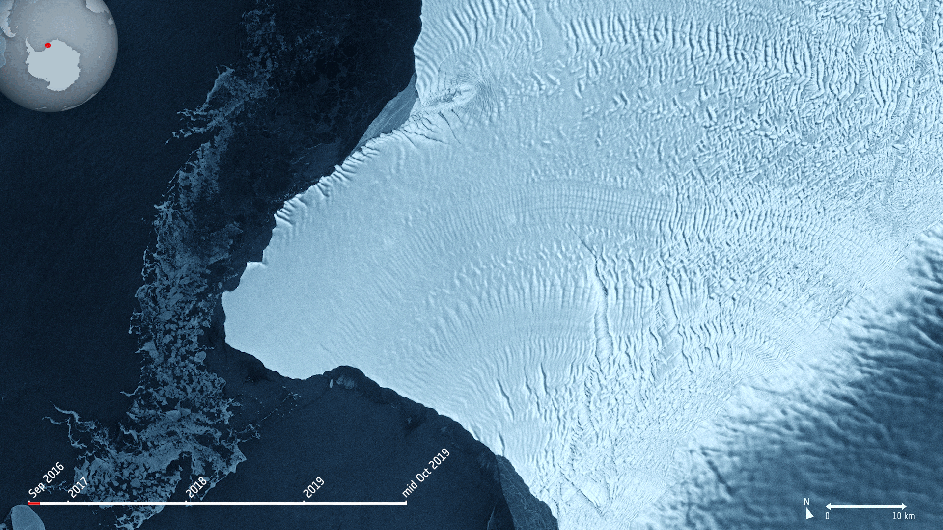
Using radar images from the Copernicus Sentinel-1 mission, the animation shows the evolution of two ice fractures from September 2016 until mid-October 2019. The large chasm running northwards is called Chasm 1, while the split extending eastwards is referred to as the Halloween Crack.
First spotted on 31 October 2016, the Halloween crack runs from an area known as McDonald Ice Rumples – which is where the underside of the floating ice sheet is grounded on the shallow seabed. This pinning point slows the flow of ice and crumples the ice surface into waves.
Chasm 1 on the other hand has been in place for over 25 years. It was previously stable for many years, but in 2012, it was noticed that the dormant crack started extending northwards.
Now, Chasm 1 and Halloween crack are only separated by a few kilometres. When they meet, an iceberg about the size of Greater London will break off. The two lengthening fractures have been set to intersect for years – it’s only a matter of time for the two to meet.
The Brunt shelf has been monitored by glaciologists for decades and is constantly changing. Early maps from the 1970s indicate that the ice shelf used to be a mass of small icebergs welded together by sea ice.
Calving is a natural process of the life cycle of ice shelves. Although the iceberg is of a considerable size, it will not be the largest of icebergs to calve in Antarctica. In 2017, a chunk of Larsen C broke off spawning one of the largest icebergs on record and changing the outline of the Antarctic Peninsula.
Ice shelf movement is very unpredictable. Routine monitoring from satellites offer unprecedented views of events happening in remote regions, and show how ice shelves are responding to changes in ice dynamics, air and ocean temperatures.
As an advanced radar mission, Copernicus Sentinel-1 can image the surface of Earth through cloud and rain and regardless of whether it is day or night. This makes it an ideal mission for monitoring the polar regions, which are in darkness during the winter months and for monitoring tropical forests, which are typically shrouded by cloud.
This image is also featured on the Earth from Space video programme .
Comments are closed.