<div data-cycle-pager-template=”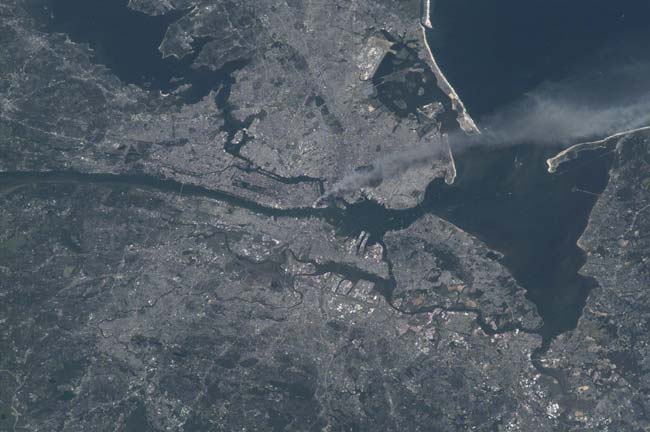 ” readability=”35.5″>
NASA Commemorates 9/11 Anniversary

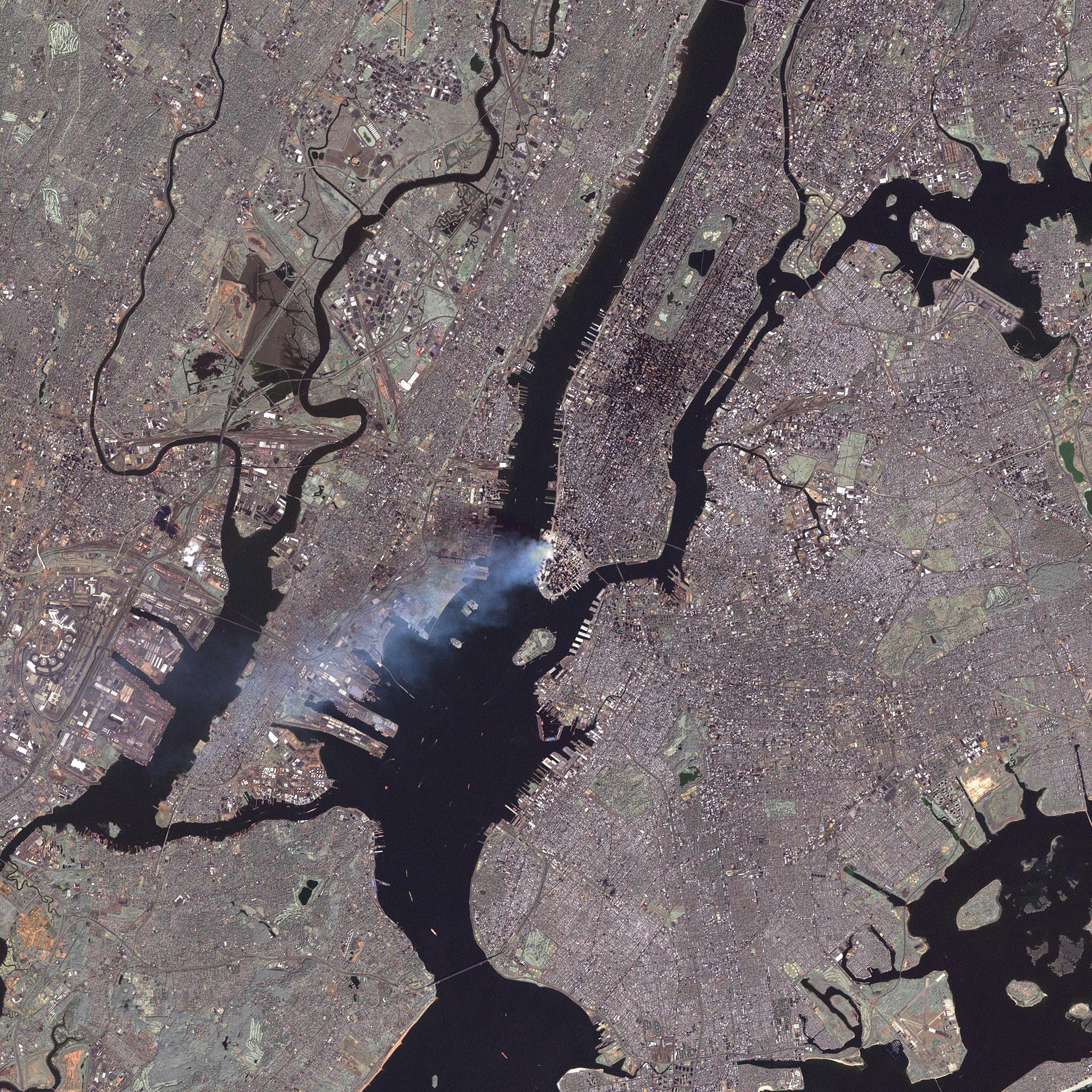
Fifteen years ago on Sept. 11, 2001, terrorist attacks that crashed planes into New York City’s World Trade Center, the Pentagon in Washington, D.C., and a field in Pennsylvania shocked the United States and the world. Satellites allowed U.S. officials to monitor the event from space. One American astronaut – NASA’s Frank Culbertson – could only look on at the tragedy from orbit as he worked on the International Space Station. You can see Culbertson’s photos of the New York City as it appeared from space on 9/11 here, along with other satellite views of the attacks and aftermath. HERE: This image is one of a series taken by Culbertson that day of metropolitan New York City by the International Space Station’s Expedition 3 crew that shows the smoke plume rising from Manhattan.
<div data-cycle-pager-template=”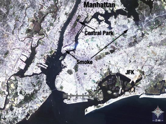 ” readability=”33.5″>
Smoke Still Rising from Manhattan Two Days Following

Landsat 5 satellite acquired this image of New York City on Sept. 13, 2001, two days after the terrorist attacks that destroyed the towers of the World Trade Center, as smoke continued to emanate from lower Manhattan.
<div data-cycle-pager-template=” ” readability=”33″>
Smoke Plume Rising from Manhattan 2
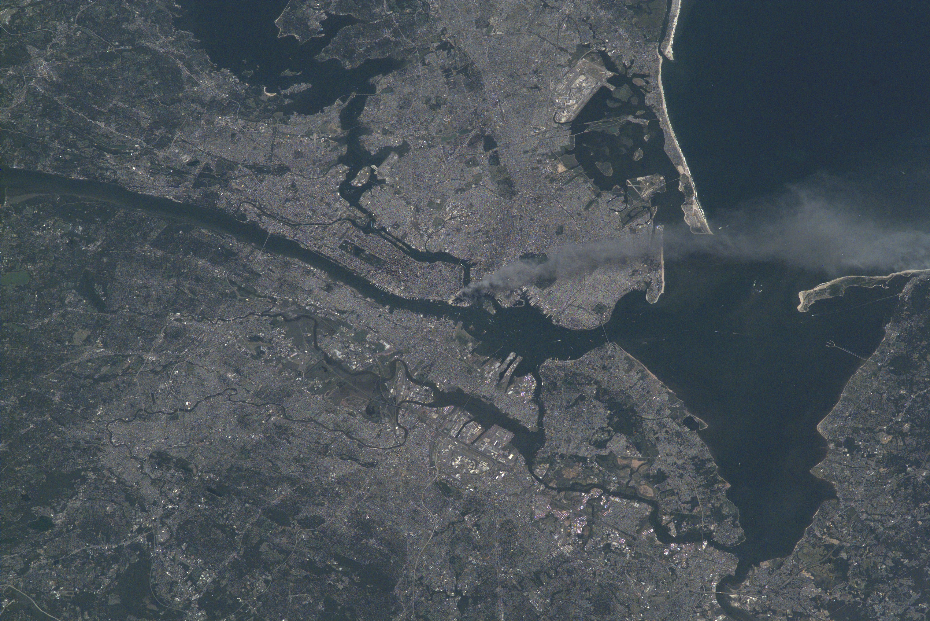
One of a series of pictures of metropolitan New York City taken by one of the Expedition Three crew members onboard the International Space Station (ISS) at various times during the day on September 11, 2001. A smoke plume rises from the Manhattan area where the World Trade Center was destroyed. The orbital outpost was flying at an altitude of approximately 250 miles.
<div data-cycle-pager-template=” ” readability=”33.5″>
SPOT Satellite Image of World Trade Center Fires
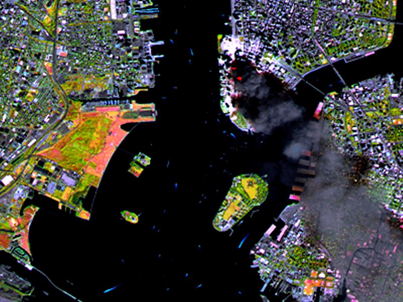
SPOT satellite image of Manhattan, acquired on September 11 at 11:55 AM EST, 3 hours after two planes crashed into the World Trade Center. The colors result from the use of infrared bands to identify the actual fire hot spots (see red spots near the base of the smoke plume). The SPOT satellites orbit at an altitude of 822 km.
<div data-cycle-pager-template=”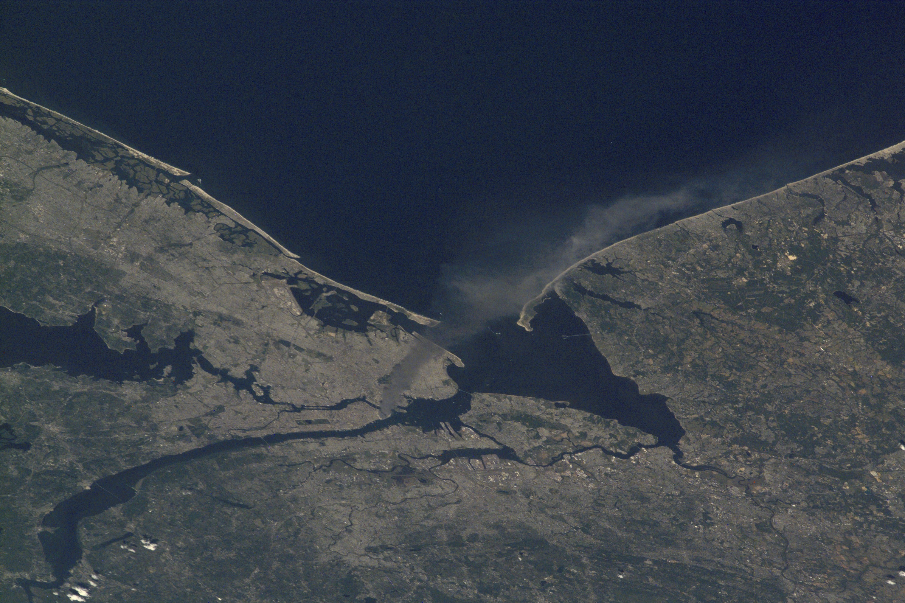 ” readability=”33″>
Smoke Plume Rising from Manhattan 3

One of a series of pictures of metropolitan New York City taken by one of the Expedition Three crew members onboard the International Space Station (ISS) at various times during the day on September 11, 2001. A smoke plume rises from the Manhattan area where the World Trade Center was destroyed. The orbital outpost was flying at an altitude of approximately 250 miles.
<div data-cycle-pager-template=”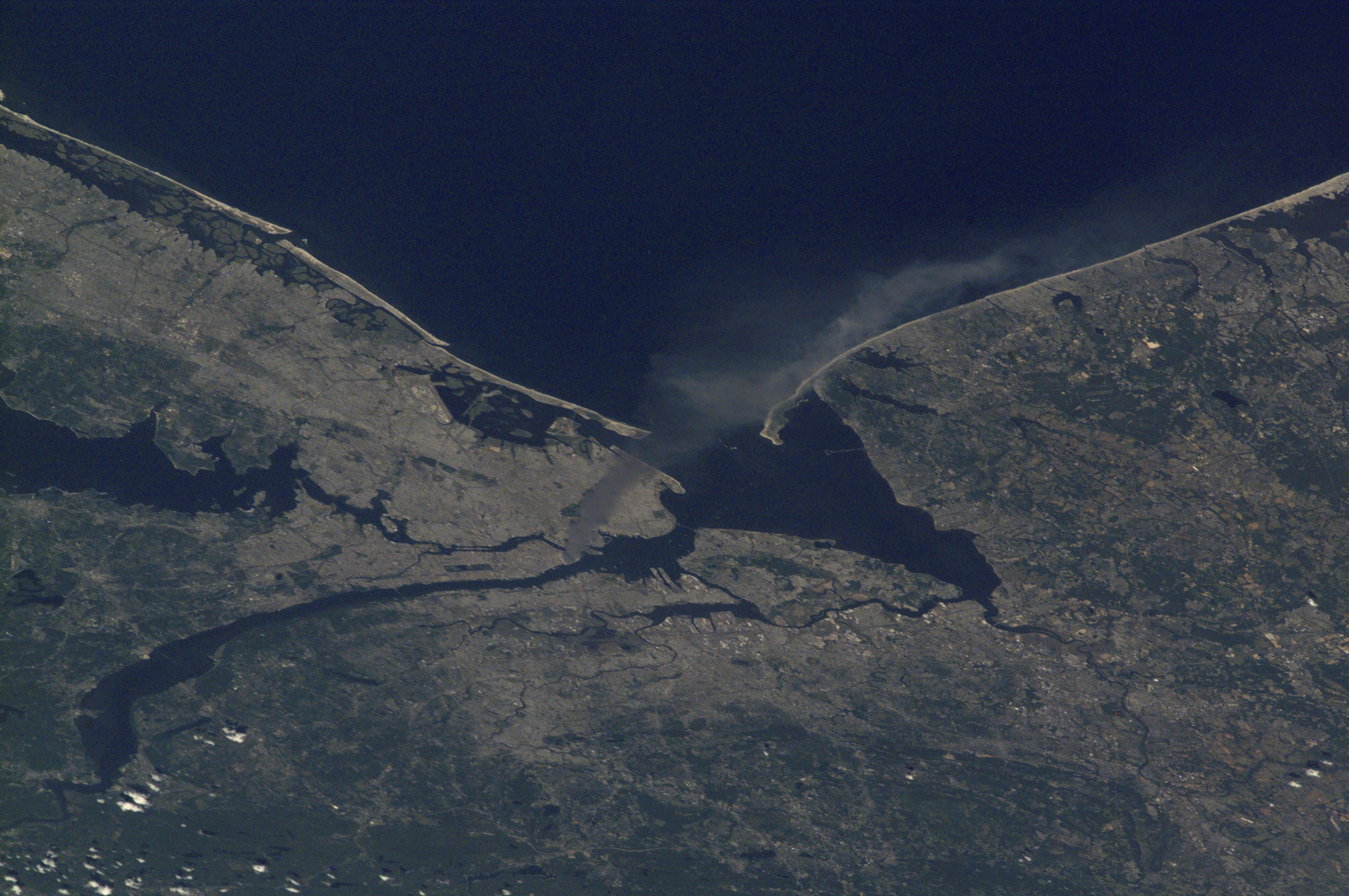 ” readability=”33″>
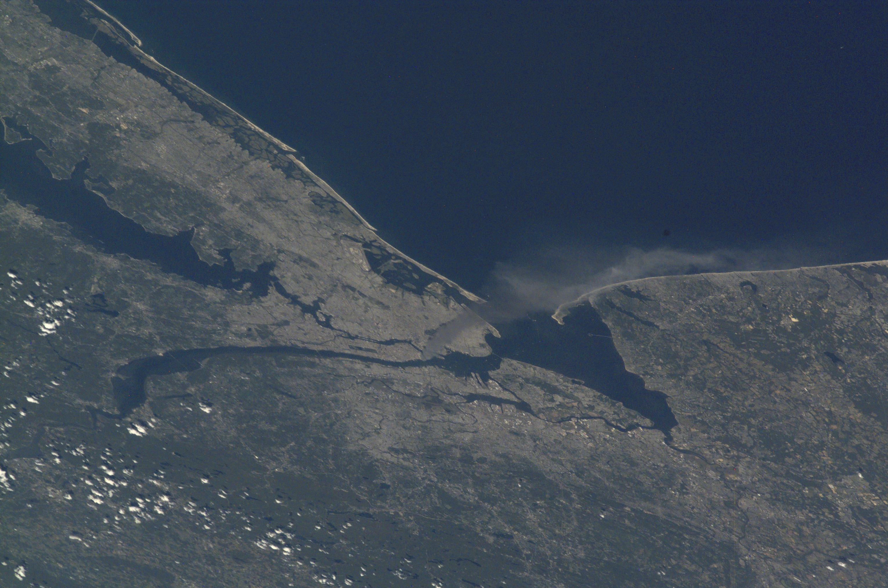
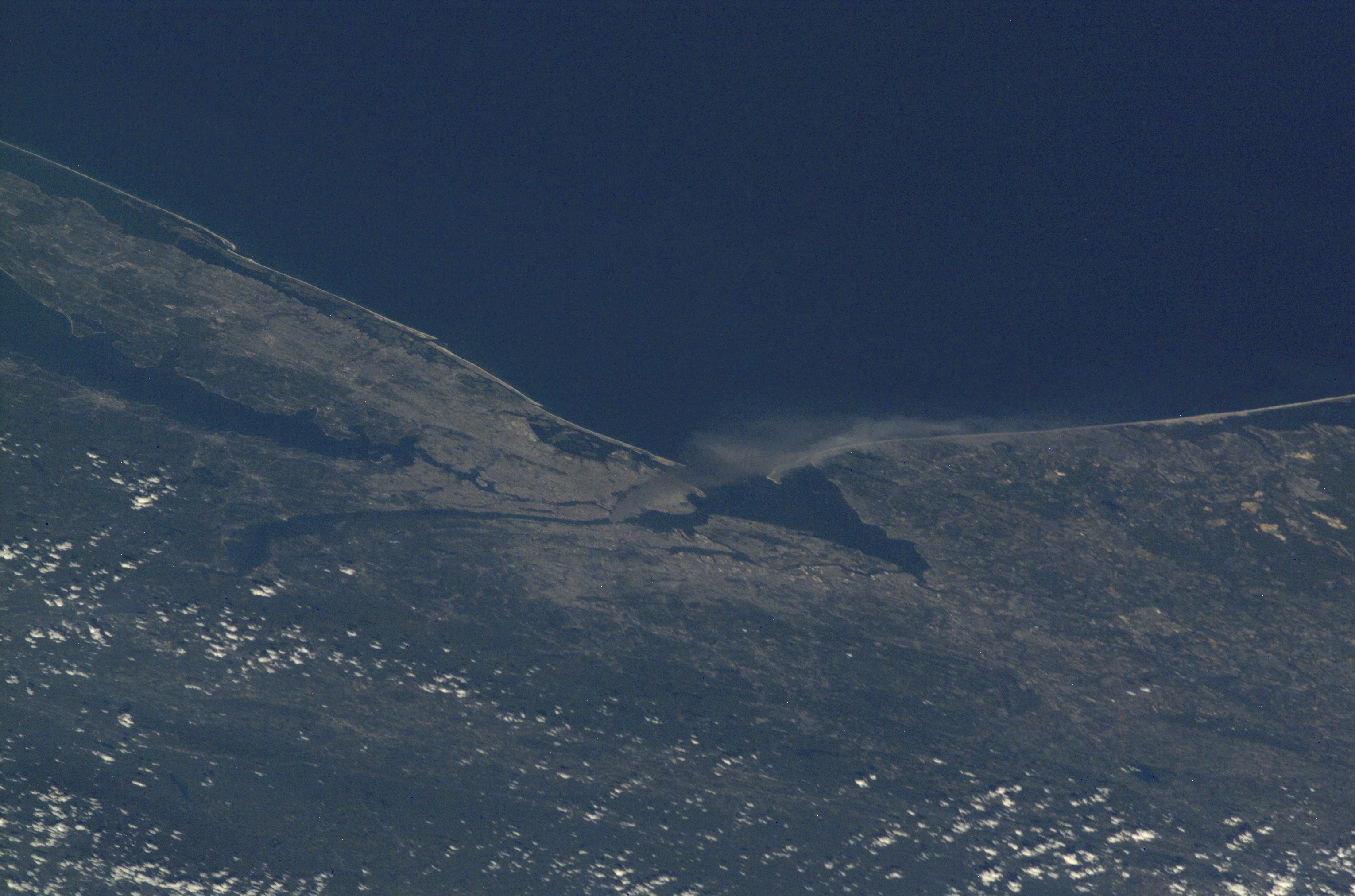
Smoke Plume Rising from Manhattan 4

One of a series of pictures of metropolitan New York City taken by one of the Expedition Three crew members onboard the International Space Station (ISS) at various times during the day on September 11, 2001. A smoke plume rises from the Manhattan area where the World Trade Center was destroyed. The orbital outpost was flying at an altitude of approximately 250 miles.
<div data-cycle-pager-template=”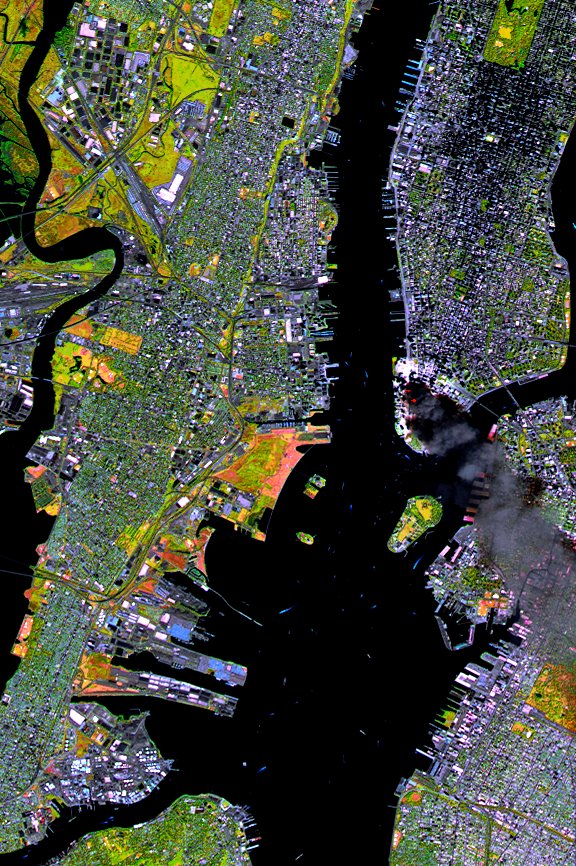 ” readability=”33.5″>
SPOT Satellite Images of World Trade Center Fires (Wider)

SPOT satellite image of Manhattan, acquired on September 11 at 11:55 AM EST, 3 hours after two planes crashed into the World Trade Center. The colors result from the use of infrared bands to identify the actual fire hot spots (see red spots near the base of the smoke plume). The SPOT satellites orbit at an altitude of 822 km.
<div data-cycle-pager-template=” ” readability=”33″>
Smoke Plume Rising from Manhattan 5
One of a series of pictures of metropolitan New York City taken by one of the Expedition Three crew members onboard the International Space Station (ISS) at various times during the day on September 11, 2001. A smoke plume rises from the Manhattan area where the World Trade Center was destroyed. The orbital outpost was flying at an altitude of approximately 250 miles.
<div data-cycle-pager-template=”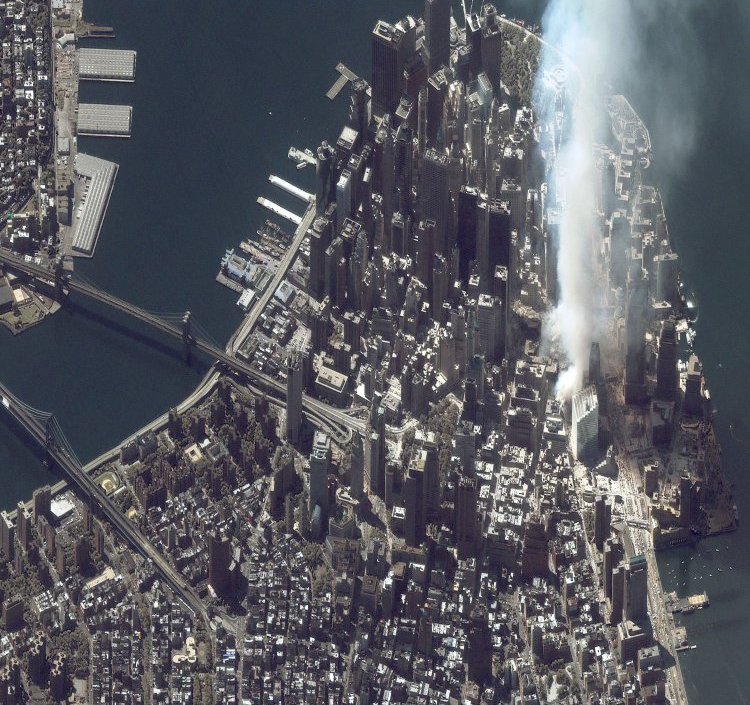 ” readability=”35″>
World Trade Center Aftermath as Seen by IKONOS Satellite

This one-meter resolution satellite image of Manhattan, New York was collected at 11:43 a.m. EDT on Sept. 12, 2001, by Space Imaging’s IKONOS satellite. The image shows an area of white dust and smoke at the location where the 1,350-foot towers of the World Trade Center once stood. IKONOS travels 423 miles above the Earth’s surface at a speed of 17,500 miles per hour.
<div data-cycle-pager-template=”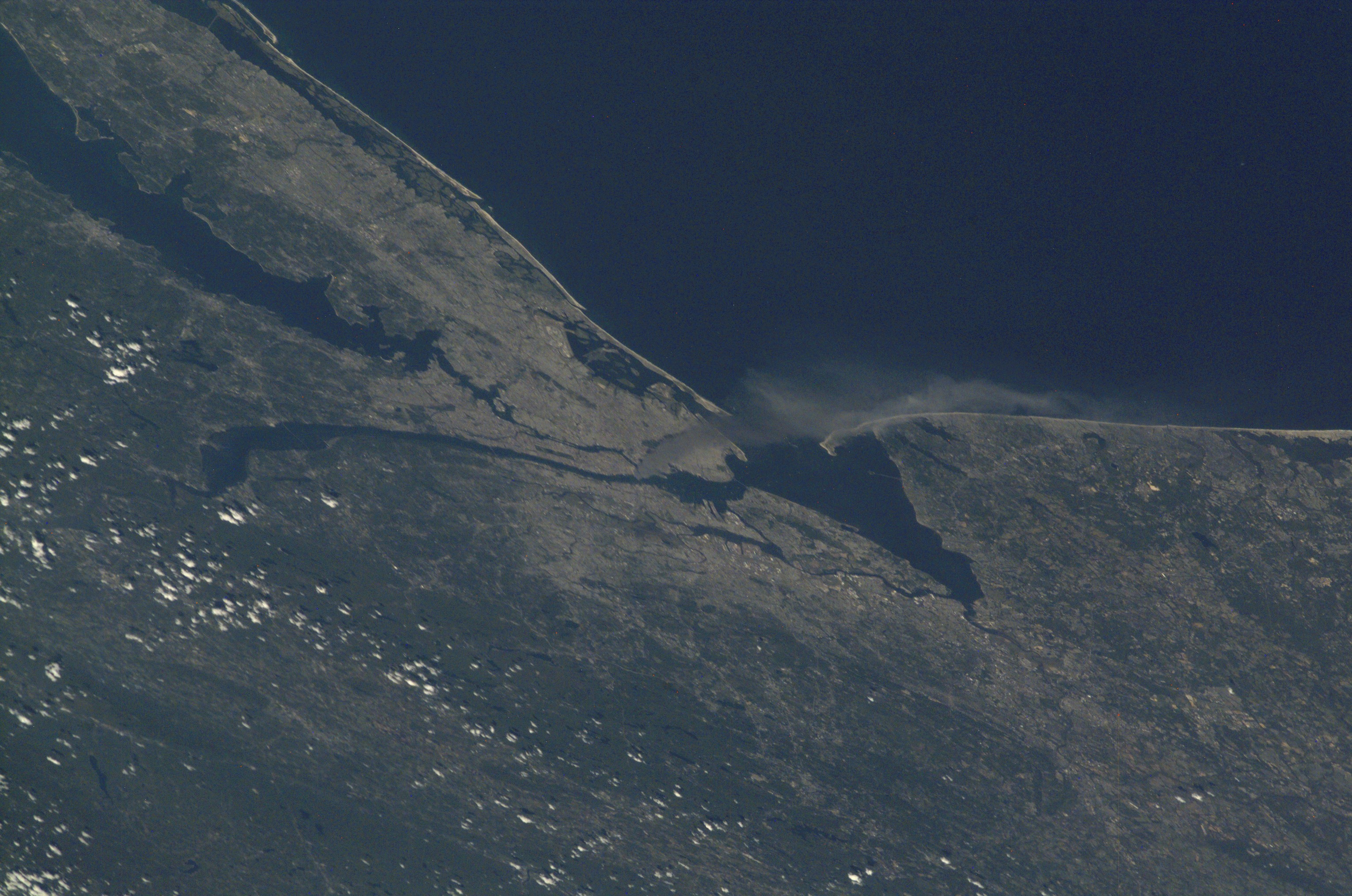 ” readability=”33″>
Smoke Plume Rising from Manhattan 6

One of a series of pictures of metropolitan New York City taken by one of the Expedition Three crew members onboard the International Space Station (ISS) at various times during the day on September 11, 2001. A smoke plume rises from the Manhattan area where the World Trade Center was destroyed. The orbital outpost was flying at an altitude of approximately 250 miles.
<div data-cycle-pager-template=”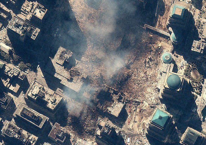 ” readability=”35″>
World Trade Center Aftermath as Seen by IKONOS Satellite

Space Imaging’s IKONOS satellite collected this image of Manhattan, New York at 11:54 a.m. EDT on Sept. 15, 2001. The image shows the remains of the 1,350-foot towers of the World Trade Center, and the debris and dust that settled throughout the area. Also visible are many emergency and rescue vehicles in the streets. IKONOS orbits 423 miles above the Earth’s surface at a speed of 17,500 miles per hour.
<div data-cycle-pager-template=” ” readability=”33″>
Smoke Plume Rising from Manhattan 7
One of a series of pictures of metropolitan New York City taken by one of the Expedition Three crew members onboard the International Space Station (ISS) at various times during the day on September 11, 2001. A smoke plume rises from the Manhattan area where the World Trade Center was destroyed. The orbital outpost was flying at an altitude of approximately 250 miles.
<div data-cycle-pager-template=”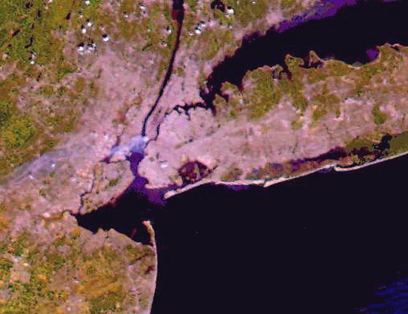 ” readability=”32.5″>
NASA’s Terra Satellite 9/11 Image

NASA’s Terra Satellite True-Color Image, taken Sept. 12, 2001 by the Moderate-resolution Imaging Spectroradiometer (MODIS) instrument aboard NASA’s Terra Satellite.
<div data-cycle-pager-template=”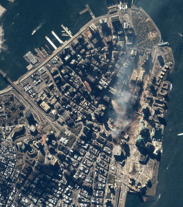 ” readability=”35″>
World Trade Center Aftermath as Seen by IKONOS Satellite

Space Imaging’s IKONOS satellite collected this image of Manhattan, New York at 11:54 a.m. EDT on Sept. 15, 2001. The image shows the remains of the 1,350-foot towers of the World Trade Center, and the debris and dust that settled throughout the area. IKONOS orbits 423 miles above the Earth’s surface at a speed of 17,500 miles per hour.
<div data-cycle-pager-template=”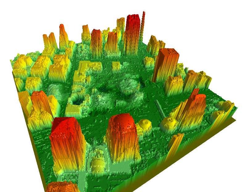 ” readability=”35.5″>
NOAA Digital Surface Models Created by the LIDAR System September 28, 2001

Digital Surface Models created by the LIDAR (Light Detection and Ranging) system provide very accurate 3-dimensional positioning of the building structures and the surrounding area. The 3-D models, in this case, have helped to locate original support structures, stairwells, elevator shafts, basements, and other features.
<div data-cycle-pager-template=”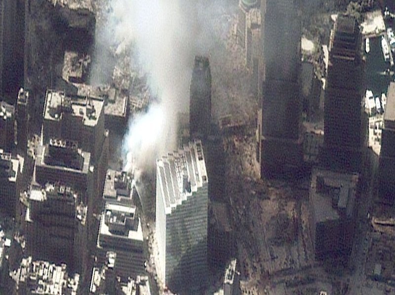 ” readability=”34.5″>
World Trade Center Aftermath as Seen by IKONOS Satellite

This one-meter resolution photo of Manhattan, New York was collected at 11:43 a.m. EDT on Sept. 12, 2001 by Space Imaging’s IKONOS satellite. The image shows an area of white dust and smoke at the location where the 1,350-foot towers of the World Trade Center once stood. IKONOS travels 423 miles above the Earth’s surface at a speed of 17,500 miles per hour.
<div data-cycle-pager-template=”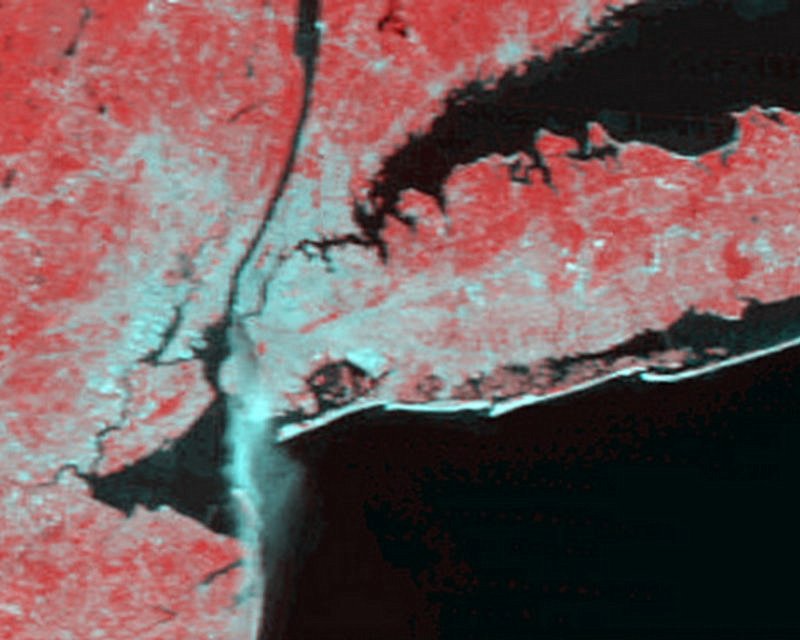 ” readability=”33.5″>
NASA’s Terra Satellite Shows the Fire Plume from Manhattan

Image from NASA’s Terra Satellite shows the fire plume from Manhattan after the terrorist attack on the World Trade Center. These images were put together from Moderate-resolution Imaging Spectroradiometer (MODIS) data at the NASA Goddard Space Flight Center, Greenbelt, MD. They were taken from an altitude between 620 and 876 nautical miles above the Earth’s surface.
<div data-cycle-pager-template=” ” readability=”32″>
Sept. 12, 2001: The Day After
Smoke can still be seen at the site at around 11:30 a.m. on Sept. 12, in this image from the Landsat 7 satellite.
Comments are closed.