Image:
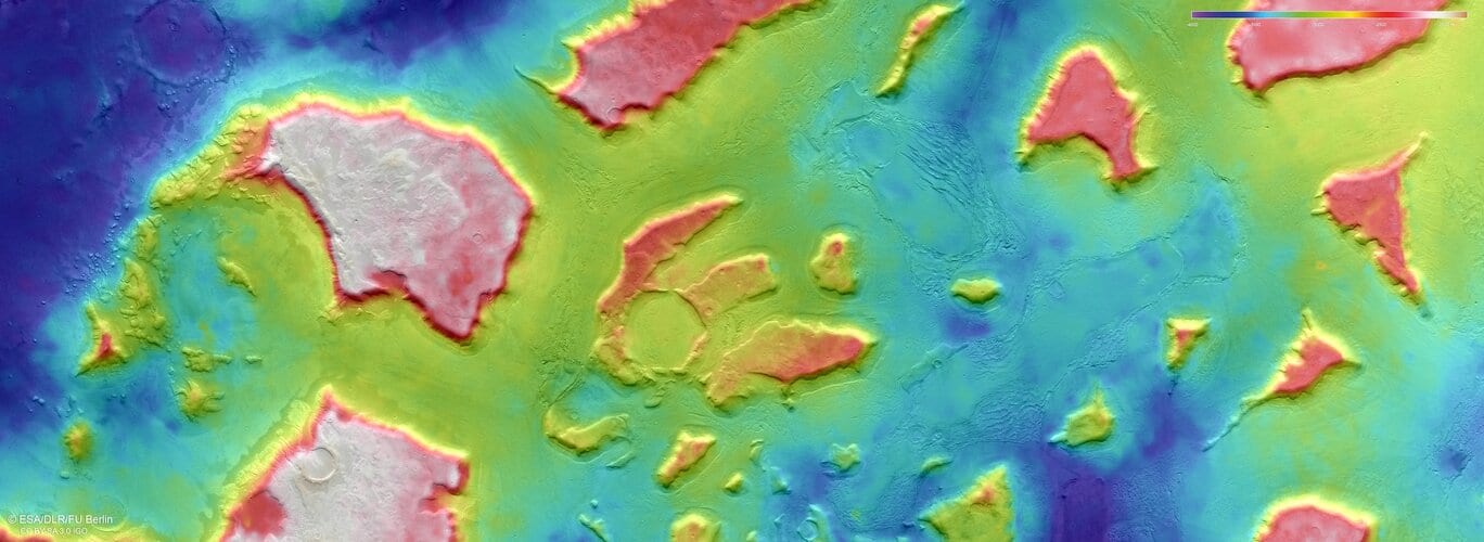
This colour-coded topographic view shows a region of Mars named Deuteronilus Mensae. Lower parts of the surface are shown in blues and purples, while higher altitude regions show up in whites, yellows and reds, as indicated on the scale to the top right. This view is based on a digital terrain model of the region, from which the topography of the landscape can be derived. It comprises data gathered on 25 February 2018 during orbit 17913. The ground resolution is approximately 13 m/pixel and the images are centred at about 25.5°E/44°N. North is to the right.
Comments are closed.