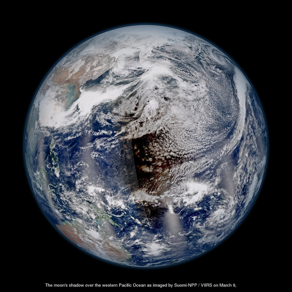
The shadow of the moon is clearly visible on Earth’s Pacific Ocean in this spectacular full-planet view of the total solar eclipse of March 8/9, 2016 from space by the NASA-NOAA Suomi-NPP satellite.
Credit: NASA/NOAA/GSFC/Suomi NPP/VIIRS
The moon’s shadow covers part of the South Pacific Ocean like a ragged brown blanket in newly released satellite photos of Tuesday’s (March 8) total solar eclipse.
The most breathtaking satellite view so far of the 2016 total solar eclipse comes from NASA’s Suomi-NPP. The Earth-watching satellite used its VIIRS instrument to capture a view of the moon’s shadow on Earth’s Pacific Ocean during the eclipse.
“There’s no #oceancolor in a moon shadow, moon shadow, moon shadow,” NASA officials wrote on Twitter in an image description by the agency’s @NASAOceans team. [See photos of the 2016 total solar eclipse ]


The total solar eclipse of March 8, 2016, as seen from orbit by NASA’s Aqua satellite.
Credit: NASA Goddard MODIS Rapid Response Team
Another image was captured by NASA’s Aqua satellite at 10:05 p.m. EST Tuesday (0305 GMT on Wednesday, March 9). It provides a bird’s-eye view of the total solar eclipse , which was visible from the ground only along a 90-mile-wide (145 kilometers) path that stretched through Sumatra, Sulawesi, Borneo and other islands eastward into the Pacific northeast of Hawaii.
Tuesday’s event was seen as a partial solar eclipse by skywatchers in a much broader swath that included Hawaii and parts of Alaska, Australia and Southeast Asia.
There will be no more total solar eclipses this year. However, on Sept. 1, parts of Africa will be treated to an “annular eclipse,” in which the moon blots out most of the sun but leaves a ring blazing around the outside of the solar disk.
And skywatchers in the United States should circle Aug. 21, 2017 on their calendars. On that date, a total solar eclipse will be visible from a path that stretches from Oregon all the way to South Carolina — a highly anticipated event that has been dubbed the “Great American Eclipse.”
The Aqua satellite launched in 2002. Its chief mission involves collecting a variety of information about Earth’s water cycle. The Suomi-NPP satellite launched in 2011. Its name is short for Suomi National Polar-orbiting Partnership and the satellite is a joint mission by NASA and National Oceanic and Atmospheric Administration.
Editor’s note: If you safely captured an amazing photo of Tuesday’s total solar eclipse and would like to share it with us and our news partners for a story or gallery, send images and comments in to Managing Editor Tariq Malik at spacephotos@space.com.
Follow Mike Wall on Twitter @michaeldwall and Google+ . Follow us @Spacedotcom , Facebook or Google+ . Originally published on Space.com .

Comments are closed.