3 min read
Sols 4352-4354: Halloween Fright Night on Mars

Earth planning date: Friday, Nov. 1, 2024
Yesterday evening (Thursday) was Halloween for many of us here on Earth. My neighborhood in eastern Canada was full of small (and not so small!) children, running around in the dark collecting sweets and candy but also getting scared by the ghostly decorations hung at each house. Little did we suspect that our poor rover on Mars was also getting spooked. Curiosity completed about a meter (about 3 feet) of the planned drive before becoming unsettled … scared, if you will! … when its left front wheel got hung up on a rock and stopped moving.
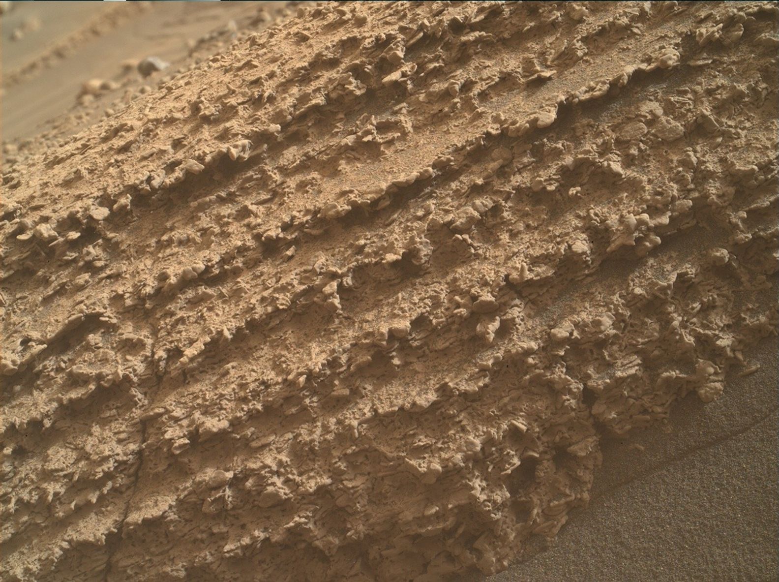
Luckily, we understood this kind of frightened behavior and were able to resume planning today as per usual. That meter was enough to give us a whole new set of targets to choose from. As APXS Strategic Planner this week, I had chosen darker-looking targets in the workspace — “Ladder Lake” and “Reds Meadow” (shown in the accompanying MAHLI image) — earlier in the week . I was happy that bumping backwards by a meter allowed us to reach some of the more typical pale colored bedrock at “Eureka Valley” and a second APXS analysis on “Black Bear Lake,” which is a mixture of both pale bedrock and some darker layers. MAHLI added in a bonus set of images on “Stag Dome,” focusing on small, rougher patches on the pale bedrock.
ChemCam is taking advantage of the short bump, too, adding a passive observation on the brushed Reds Meadow target, analyzed by APXS and MAHLI in Monday’s plan. A ChemCam LIBS target “Hoist Ridge” focuses on a small vertical face of dark material. Two long distance images planned for ChemCam’s Remote Micro Imager (RMI) look at the distribution of rocks along the Gediz Vallis ridge in the distance.
Mastcam is taking several mosaics this weekend (must have gotten extra energy from the Halloween sugar!). Close to the rover, Mastcam will acquire single-frame images of the targets Hoist Ridge and Eureka Valley, and a small mosaic of some surficial troughs just a little further away. Moving further afield, a small 3×1 mosaic (three images in one row) will image the same area as the ChemCam RMI of the Gediz Vallis ridge, and a larger 9×2 mosaic will focus on the faraway yardang unit, where we hopefully will be in a few years.
Then for the really big images: Mastcam will image the whole landscape in a special 360-degree view, so big it needs to be broken into two parts. The first will have 43×4 frames, the second 34×5 frames. These mosaics are huge, so we save them for when we are at a really good vantage point to allow us to capture as much detail as possible for science and engineering planning.
As ever, we continue our environmental monitoring of conditions, with Mastcam and Navcam movies and images looking at dust in the atmosphere above and around us in Gale crater, and watching out for dust devils.
Written by Catherine O’Connell-Cooper, Planetary Geologist at University of New Brunswick


Comments are closed.